

After hiking Shakadang Trail I was convinced I needed to see more of Taroko National Park and decided to take my scooter to the highest peak. Doing some quick research at my hostel I discovered Xiafengkou(siafengkou) had a 2 hour hike to the top of Hehuanshan at an altitude of 3,416m. Locals told me the view from here was spectacular and the trip itself was an experience worth any adventure seeker. They also warned me of a bridge that closes at 5:00pm halfway up the mountain which meant I was departing Hualien at 7:00am.

The 45 minute ride past the Pacific Ocean to Taroko National Park happily revealed blue skies and hinted at a gorgeous day. I questioned whether I truly needed all these layers, gloves and hand warmers that I was advised to take but then I remembered 3416 meters. That’s over 11,000 feet! I guess 2 miles of elevation gain can do some wonky things to the weather.
Taroko National Park is home to some of the best trails in Asia!
I stopped at the visitor center to check on any permits or permissions needed for this trip ad unfortunately found out they open at 8:30am so I skipped along into the gorge. Quickly passing Shakadang Trail the right side of the road dropped off into an eternal cliff with gushing water beneath. The marble chasm dropped gigantic boulders and crystal blue waters in a natural glory.
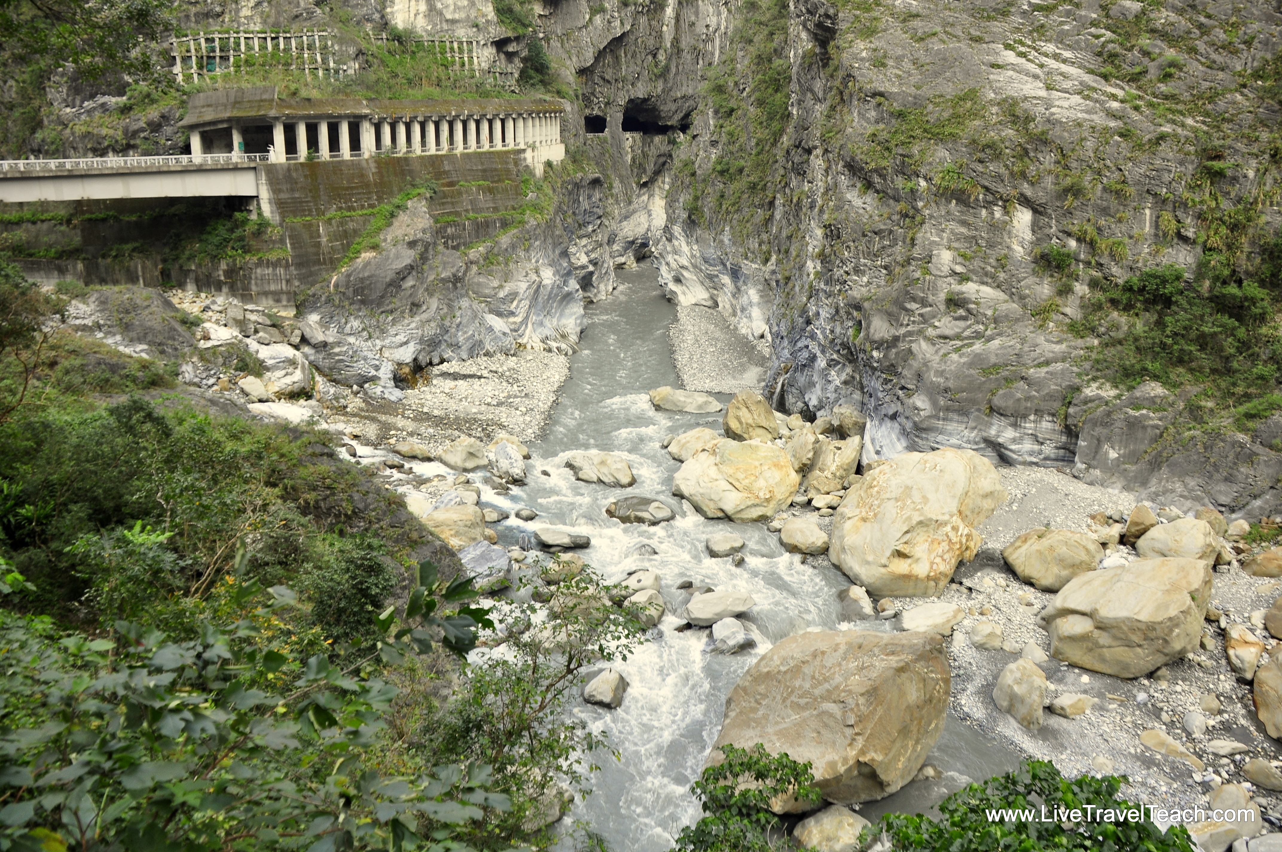
The only respite from the hazardous cliff was innumerable tunnels carved through the mountain. Swerving around corners following the river made for an exciting ride and something I would happily do again. Along the way you’ll see suspension bridges often signalling trailheads with locked doors. The park strictly allows minimal hikers on these dangerous trails so if you’re seeking an even crazier hike be sure to get a permit ahead of time!
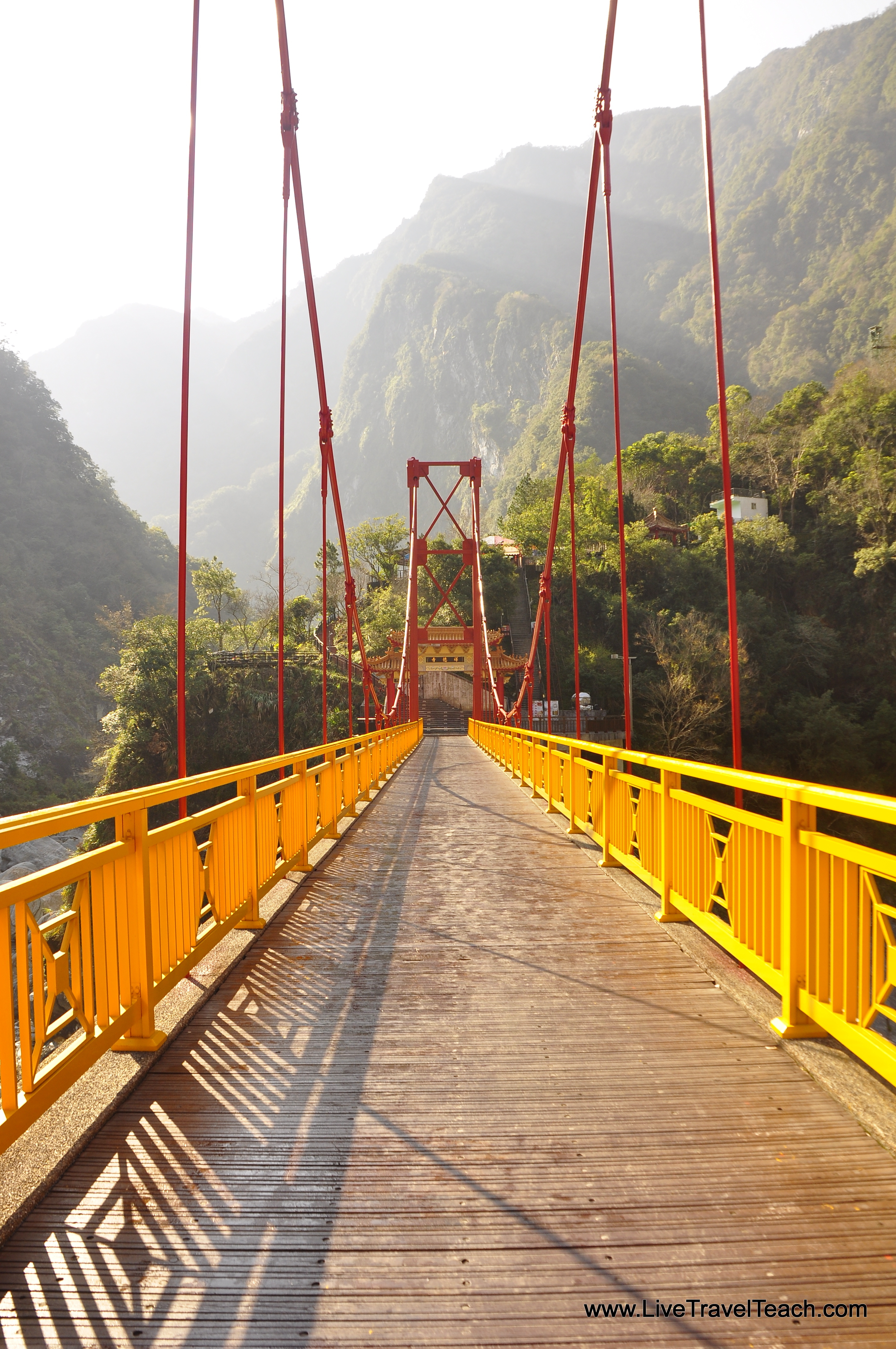
My first stop was Tianshiang village near Cimu bridge (the one that closes at 5:00pm) I decided to stop in their police station to see if I would need a permit for my trek in Xiafengkou. Arriving just before they opened at 9:00am I wandered over to the Buddhist temple overlooking this intersection. From the vantage point incense fills your senses as you stare hundreds of feet below watching 2 beautiful rivers dance together forming the immense flow that carved Taroko Gorge.

Back at the police station they had no idea what Xiafengkou was until I pulled out Google Translate. Luckily I had already downloaded the Chinese language pack but just in case the station has free wifi. Next door you’ll find a 7-11 and some other small vendors so you can resupply. I was happily informed that my trail didn’t require any permits and sped off up and up once more.
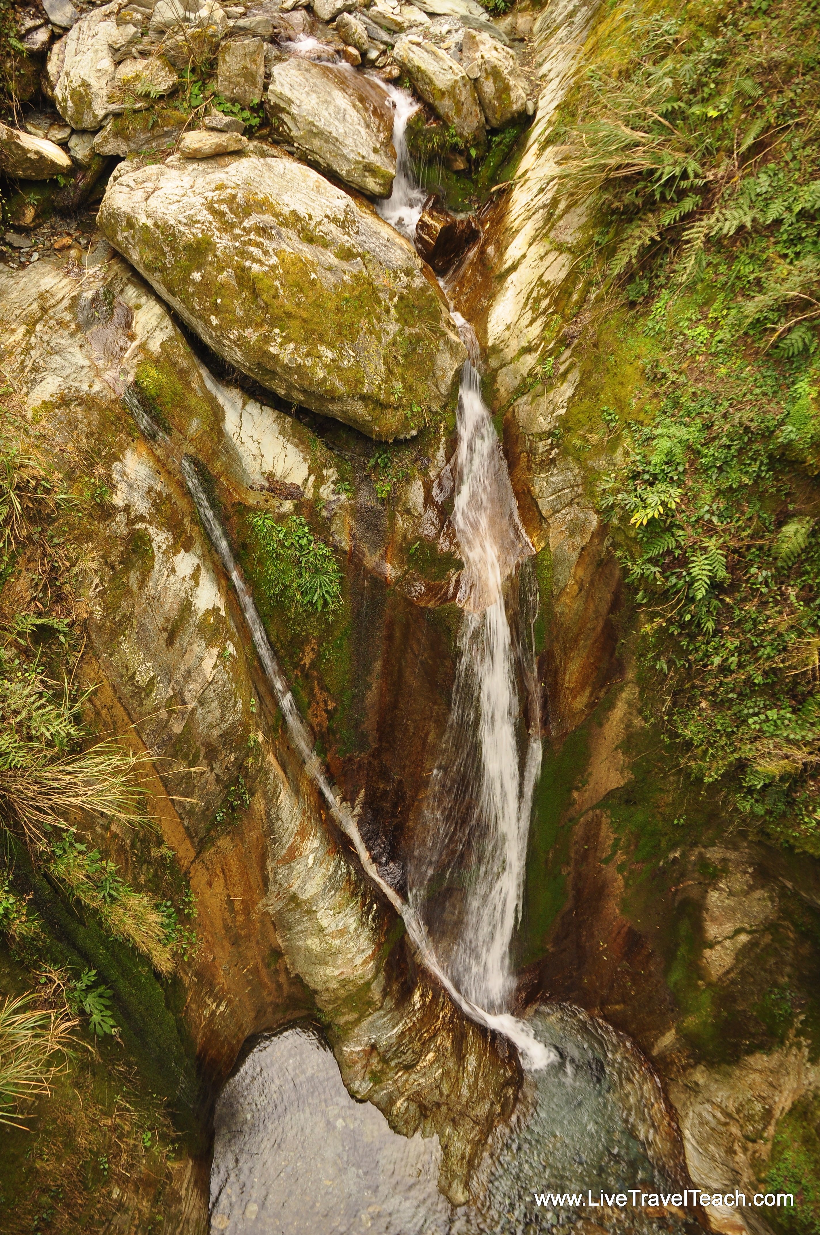
The rock wall along my road turned green with mosses as the lush jungle crept onto the road. Slowly the walls became an overhang that turned into another tunnel and quickly disappeared again. In the distance I could see monumental peaks and tried to decipher which one I was heading to. No matter which one I’m sure it’ll be great I thought to myself before noticing a trickling waterfall next to the curb.

For the next few kilometers scattered waterfalls brought a smile to my face and slowed me down demanding photographs. 300 days of rain a year make it easy to see why Taroko Gorge is so lush and green making it a must stop for anyone with more than a few days in Taiwan!
Swerving around dozens more curves and cliffs I was reminded of the Mae Hong Son Loop. Unlike that 800km journey through Northern Thailand Taroko Gorge felt developed and safe with well built roads and mirrors reflecting around each blind corner. Back in Thailand you hug the corner and honk praying for no asshole trucks speeding along. Here in Taiwan the roads are wider with fewere potholes and a guard rail that actually looked like it would stop me if I accidentally skidded to the edge.
I decided not to delay too long with a 5:00 deadline to be halfway down the mountain road looming in the back of my head. I put on my last layer and sped along noticing clouds swimming around the summit and hoped they would clear for my arrival.
Before long I reached Dayuling, the last gas station before Xiafengkou. Taking the hostel’s advice I filled up and kept going. Shortly ahead the fork to Liangshan confused me so I pulled out my map and double checked. NOT Lishan I had written clearly on the map with a circle around Xiafengkou. Turning left and waving goodbye to the last tunnel of my climb I began to feel the cold clouds around me. Happy I had a few layers on but wishing there were more in my pack I recommend anyone making this trip to BRING EXTRA LAYERS & GLOVES (you can buy them for cheap at 7-11)!
In a matter of minutes I noticed snow on the side of the road and found my trailhead. Or was it the trail head? I didn’t see Xiafengkou so I kept going to find a half obstructed scenic overlook. The whole valley 3000 meters below reflected sunlight beautifully with looming clouds to my right. The wind howled and I jumped back on the bike determined to find Xiafengkou.
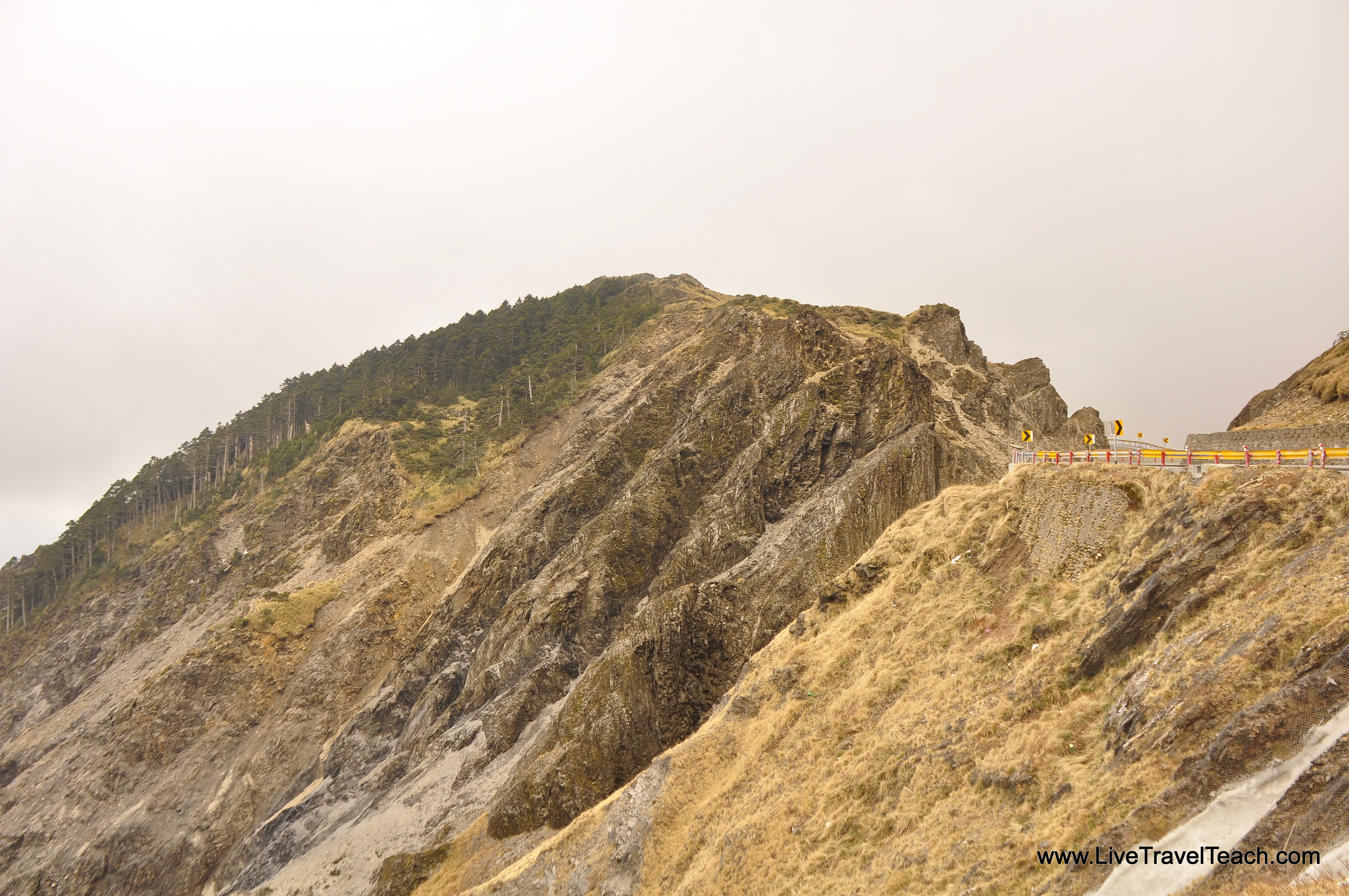
Around the next bend I saw a visitors center and decided to stop in. Coincidentally this turned out to be Xiafengkou. Either I missed the sign or it simply wasn’t written in English. Either way I found a park ranger who spoke English and told him my plan to hike to the top. His partner shuttered and said “no.” They spoke in Chinese for a minute before he turned to me and let me know a storm was coming and they didn’t think it was “good for my health” to do the 2 hour hike. He said it was actually 2 hours EACH way and with the rain it was not safe.
Discouraged but not forlorn I asked if there was another shorter option. He pulled out a chart and found a 45 minute trail to a separate peak just down the road! I thanked him profusely and went downstairs to grab a hot chocolate from the market.
Warming up my insides and my I thought of the hot packs and grabbed one discovering a sticky side. I put on the on the inside of my shirt and was trying to attach the 2nd to the backside when a short Taiwanese man walked over offering to help. He was with a woman who looked half his age but later insisted was his “wife” (or at least that’s what Google translated it as).
He slapped the other hotpack directly to my back and took out a picture of war medals. Again trusting Google Translate I discovered that his son was an airman when suddenly he turned around slapping his back and grabbing me. Not really sure what was going on he motioned to my back and then his before grabbing and stretching me over his back. Laughing he jumped a few times and I felt my back crack in delight. We took a selfie laughed and hugged at the craziness of this mountain meeting before I excused myself to find my trailhead.
Less than 15 minutes down the road I parked my scooter and stared at the steps reaching through a puffy white cloud. A sign proclaimed my destination Huanshan at 3453m. I decided to keep my motorcycle helmet on since I didn’t have a hat and felt the cold biting at my bones. Step after step this 45 minute “hike” was really a stairmaster at an immense altitude. A sign told me to be careful of altitude sickness way up here so I took regular breaks unsure if this easy fatigue was because I hadn’t hiked in weeks or the fact that I was 2 miles above the waves I stared at earlier this morning!
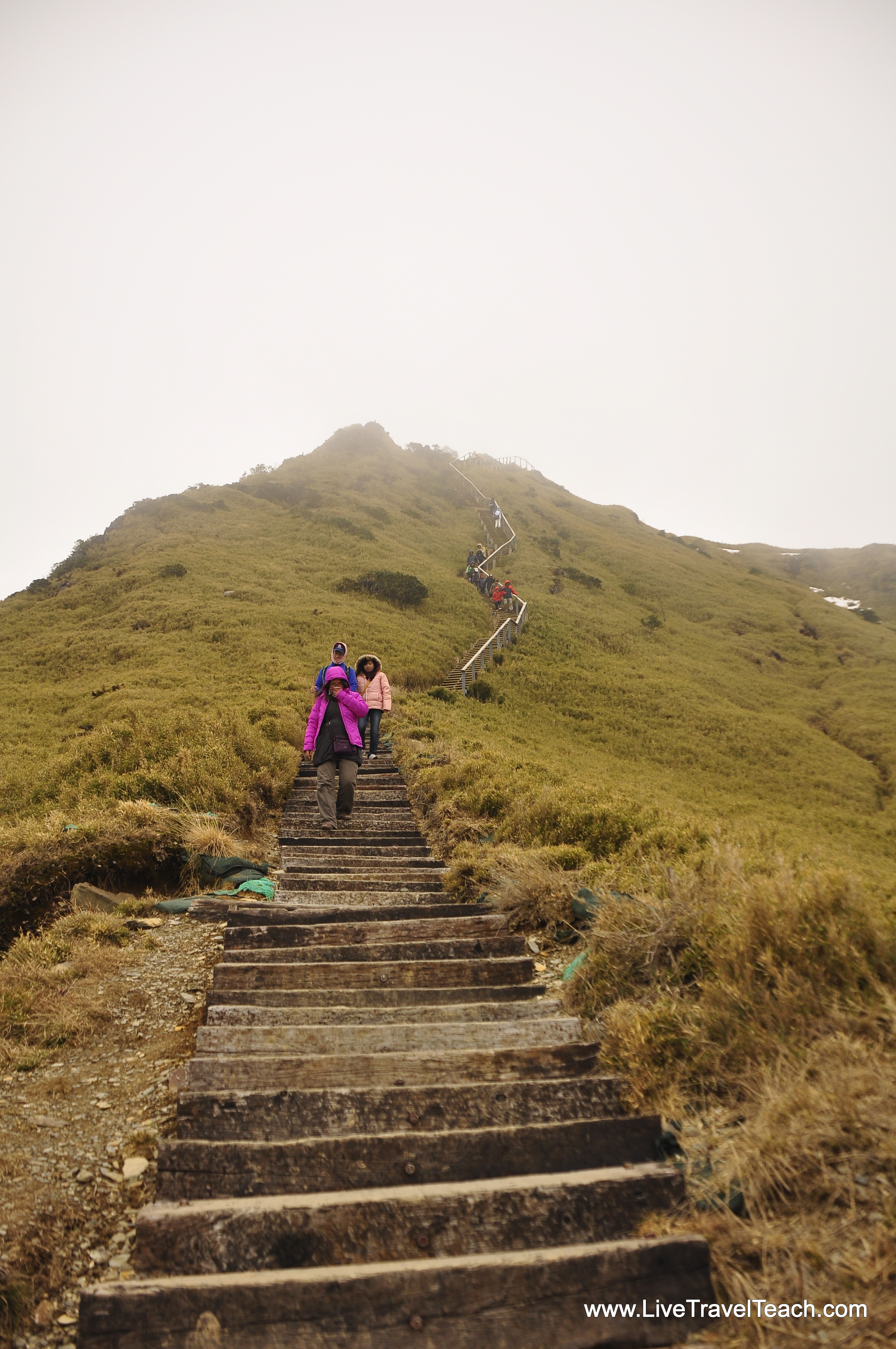
Visibility grew even dimmer as the cloud enveloped me and the entire peak in a white cocoon. Finally at the top I stared out hoping for a break in the clouds and settled for a whiteout like I’ve only ever seen in the dead of winter on top of Taebaeksan. Wind screamed past me threatening to take me with it and a light drizzle began signalling me to start the long descent.

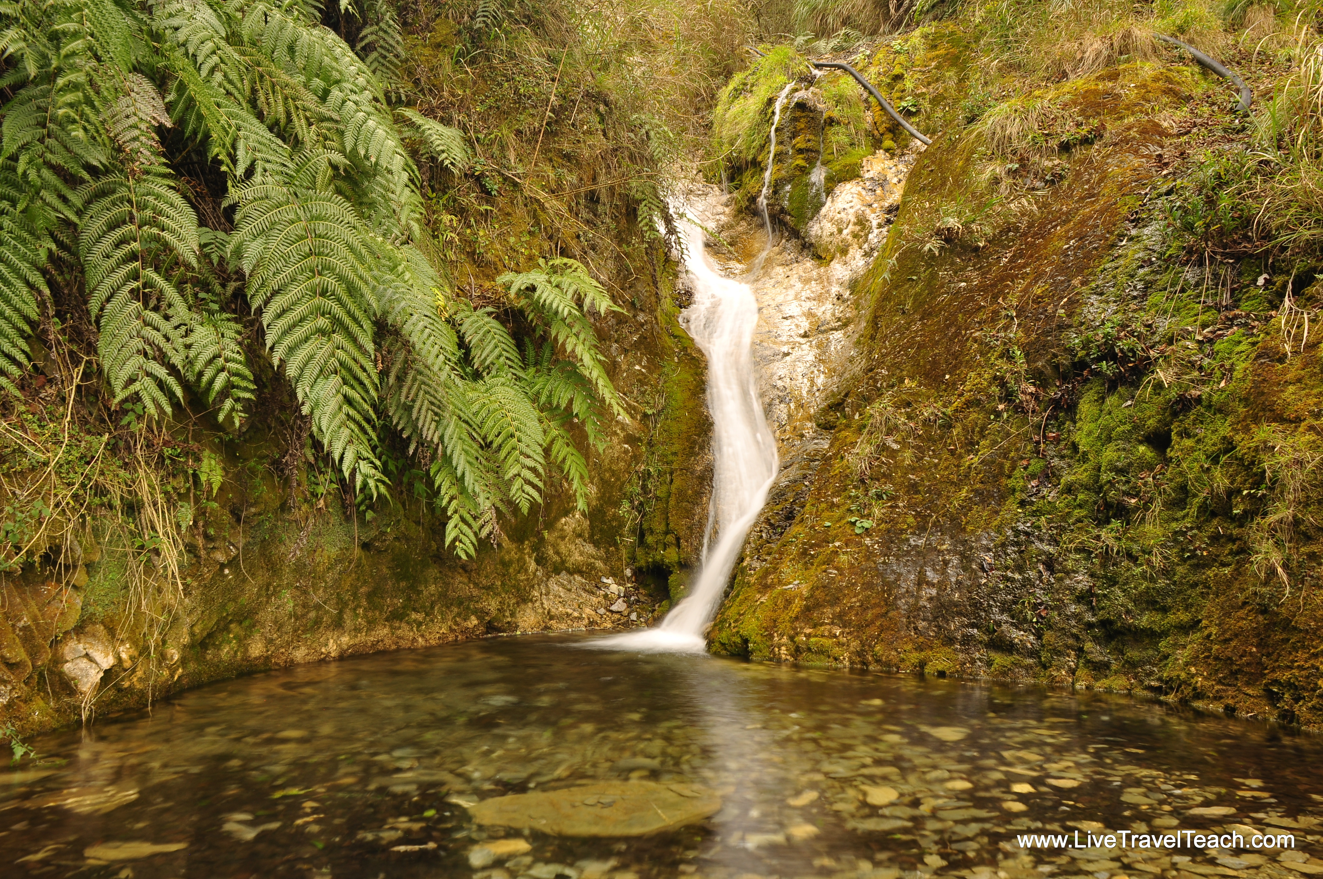
Back at my scooter I resolved to keep a slow pace on slick pavement but happily found many dry stretches. Checking the time I realized I would easily make the 5:00pm deadline for Cimu bridge and choose to stop and play with some long exposure photography at the roadside waterfalls. Wishing I could stay in this park until the sun came out but knowing I didn’t want to drive home wet and in the dark it was an easy choice to zoom past the hotels and camp sites in the park.
The waterfalls were now half obscured in a thick fog that turned once beautiful scenery into an eerie landscape reminiscent of Frodo’s trip through Mordor. It felt as if mountain spirits lurked between these moss covered trees turning a previously colorful and verdant picture into the least sensual 50 shades of gray. I did my best to embrace this mountain immersion and forced myself to slow down as visibility shrunk to mere meters ahead of my bike. Luckily the clouds stayed somewhere around 2000m altitude and merely sprinkled tears on me wishing I could stay and play.

Perhaps one day I’ll be back in Taroko Gorge but for now it will remain an experience I’ll never forget. Maybe next time I’ll get lucky with the rain and make it to another one of these majestic peaks. Until then I’ll have to settle for these photos and videos of another epic excursion into the mountains!
Have you been to Taroko? Are you planning a trip there? Tell us what you think in the comments below!


1 comment
[…] Education Conference. It was my first time couch surfing and I loved it. I even got to hike and motorbike around Taroko National […]